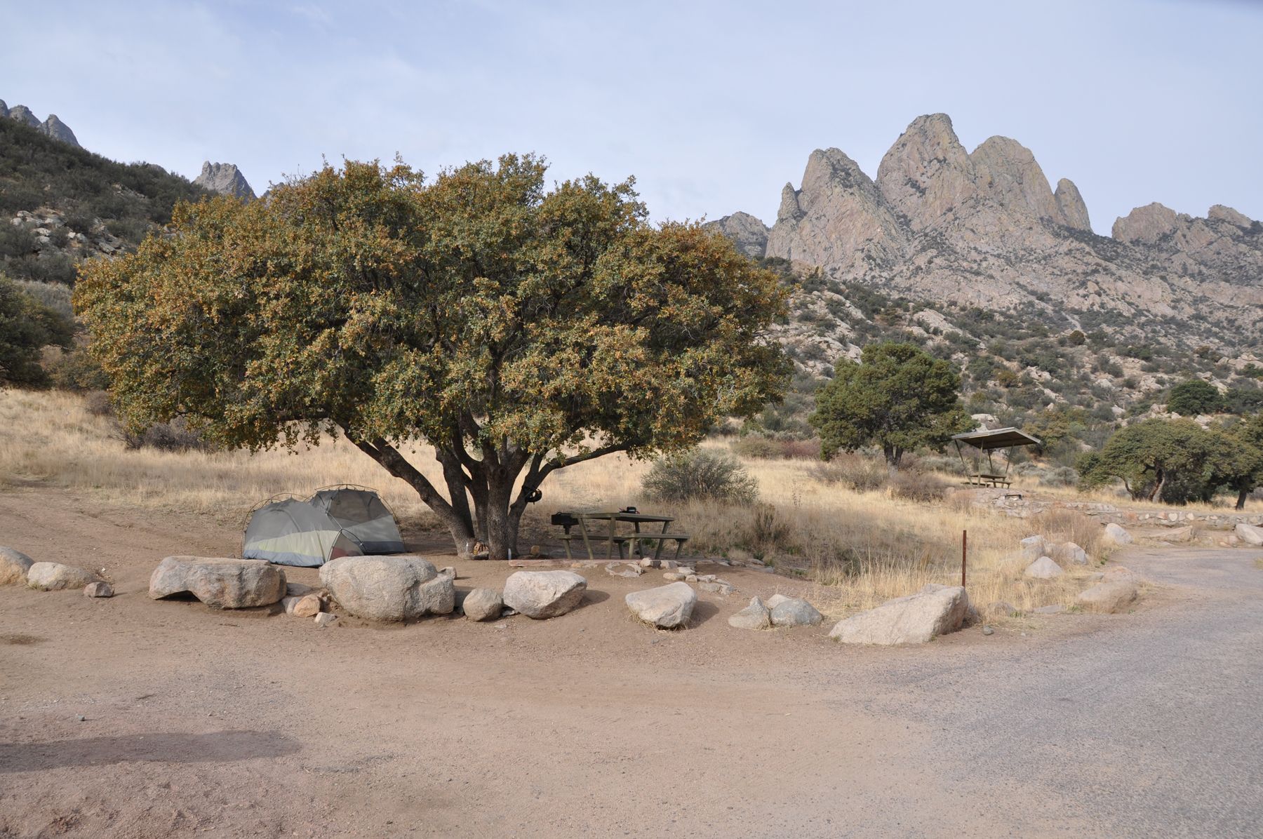
Most people know the Organ Mountains from Las Cruces, where the west face fills the eastern sky. Aguirre Spring is on the other side. A short, steep road leaves the highway beyond San Augustin Pass and climbs to a campground and picnic area tucked right under the east face, where rock towers rise above the oaks and the view runs out over the Tularosa Basin.
It is a quieter, wilder-feeling place than the west side, and one of the best spots in the region to watch the sun come up on the Organs. It lies within the Organ Mountains-Desert Peaks National Monument and is managed by the Bureau of Land Management.
Getting there
From Las Cruces, take US 70 east and north as it climbs to San Augustin Pass at the northern end of the range. On the far side, the highway drops toward the basin; a signed turn leads south onto Aguirre Springs Road. The road climbs several miles into the mountains on a steep, narrow, winding route with tight bends.
Take it slowly. Long vehicles and trailers are not suited to the road, and there are limits on vehicle length; check them before you set off with anything large. In winter, ice can linger on shaded curves. Allow about half an hour or more from Las Cruces in normal conditions.
US 70 crosses land beside the White Sands Missile Range, and the highway is sometimes closed for short periods during tests. Closures are usually announced in advance, so check before a trip that depends on timing.
The campground
The campground sits among oak, juniper and boulders at the foot of the spires, at a higher elevation than Las Cruces, which keeps it a little cooler in the warm months. Sites are spread out along loops, with picnic tables and shade structures, and there are picnic areas for day visitors. Facilities are basic.
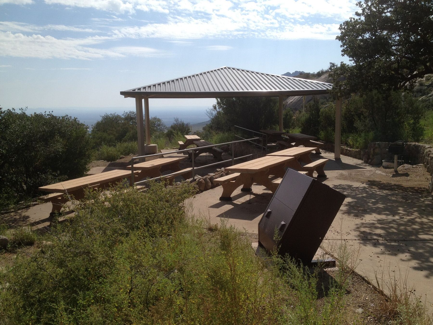
Do not count on finding drinking water; bring all you will need for cooking, washing and drinking, and more for hiking. The area is day use and camping only, with gate hours and fees that can change, and campsites are generally first come, first served. Check current rules before you go, especially in spring and autumn when weekends are busy.
Nights at this elevation can be cold well into spring and from mid-autumn, even after a warm day. Pack warm layers and a sleeping bag rated for the season.
 Down another streetDripping Springs and the old resort ruins
The Pine Tree Trail
The main walk from the campground is the Pine Tree Trail, a loop of about four miles that climbs into the woodland under the cliffs and then circles back. It gains around a thousand feet, enough to feel in your legs, and the higher sections pass through ponderosa pine, oak and juniper with views up to the spires and out across the basin.
The trail is rocky in places and partly exposed. Start early in warm weather, carry water, and wear shoes with good grip. In monsoon season, from July to September, afternoon storms can build quickly over the peaks; be off the higher ground by early afternoon.
The other trail from here is Baylor Pass, which climbs over the range and down the west side toward Las Cruces. It is a long, exposed hike, best done in cool weather with a car waiting at the far end.
The view east
From the campground and the trail, the land drops away to the Tularosa Basin, a long, flat desert valley between ranges. On a clear day you can see a pale band in the distance where the gypsum dunes of White Sands lie, and beyond them the Sacramento Mountains rising on the far side of the basin.
Much of what you see belongs to the missile range, closed to the public. The scale is the striking thing: very few lights, very few roads, and a horizon that seems far away. For more on that valley, read the story on the Tularosa Basin.
Sunrise and night sky
Because the campground faces east, it is one of the few places near Las Cruces where the Organs catch the first light. In the minutes after sunrise the spires above camp turn gold while the basin is still in shade. If you are not camping, check the gate hours to see whether an early start is possible.
With little light below, the night sky is far darker than in the valley. On moonless nights the Milky Way is clear in summer and autumn. Bring a headlamp with a red setting, and let your eyes adjust for twenty minutes before you decide what you can see.
When to go
Spring and autumn are best: mild days, cold nights and clear air. Summer is hot by day, though cooler than the valley, and brings afternoon storms. Winter can be lovely but cold, with occasional snow or ice on the road. Whatever the season, come prepared to be self-sufficient. There is no town on the doorstep, and phone signal can be patchy.
- Fill up with fuel and water in Las Cruces before you leave.
- Carry a paper map or downloaded directions in case your phone loses signal.
- Pack food, a warm layer and a first-aid kit even for a short day visit.
- Leave the boulders and plants as you find them, and carry out all trash.
A day here pairs well with the drive east. Continue down from the pass into the basin, cross to the dunes, and you have one of the great desert days in the Southwest: mountains in the morning, white sand in the afternoon.